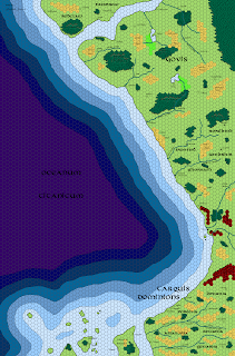
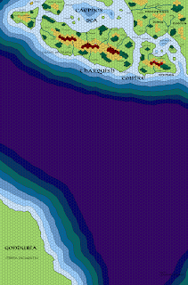
I also made a few changes to the Free States map, which I’m posting here so you can see how they fit together. The one on the bottom is the new one. Click to embiggen.
As always, the latest largest-scale versions of the maps are available off to the right in the “Free Resources” section.
You’ll also notice a corner of Gonduria off in the extreme southwest corner of the map; I deliberately didn’t put anything there, because the focus of this series is Oerik itself, and I’m leaving Gonduria as a blank slate (for the nonce…). Next stop, Ishtarland, the Red Kingdom, and the Barbarian Seameast. Only four maps to go!


You may want to take a close look at this if you are following the Lune Noir canon for the actual parameters of the Empire of Lhynn:
http://www.bdnet.com/img/couvpage/56/9782205072563_pg.jpg
That's a new map to me, oh unknown commenter. Where does it come from?
Found it. I had no idea there was a new series out!
https://www.bdfugue.com/les-chroniques-de-la-lune-noir-les-chroniques-de-la-lune-noire-hors-serie